Commercial Roofing Services
Drone roof inspection in Beaverton, OR for large or hard-to-reach commercial roofs: planned flights, annotated images and a hands-on walk of every flagged area.
Drone Roof Inspection in Beaverton, OR
Before anyone sets a ladder, the drone flies the roof. In a short flight it produces an overview that would take a crew far longer to walk: every seam line, every curb, every pooled patch, tied to a position on the plan. Drone roof inspection in Beaverton, OR is a first step for large or awkward roofs, and the images it makes become the first pages of the building file.
It is a survey tool, not a verdict. Pilots collect the pictures, and the roof team reads them and decides where hands need to go next.
The Flight Plan Comes First
Each flight begins with a plan. We confirm the roof outline, note nearby obstacles such as utility lines, rooftop antennas and tall trees, and check the airspace and the property owner's permission. The Portland metro has busy airfields, and the Portland Air National Guard Base shares its airfield with the commercial airport, so flights near controlled airspace need extra attention before takeoff.
Then the drone flies a grid at a fixed altitude, with the pilot and a spotter on the ground, to capture overlapping images of the whole surface. A second pass at lower altitude targets edges, penetrations and any area that looked unusual. Wind and light conditions matter, and we reschedule when either degrades the images.
What the Camera Sees
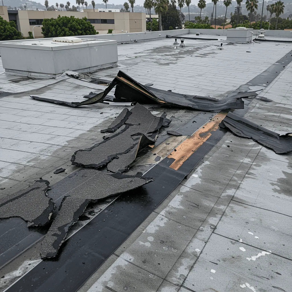
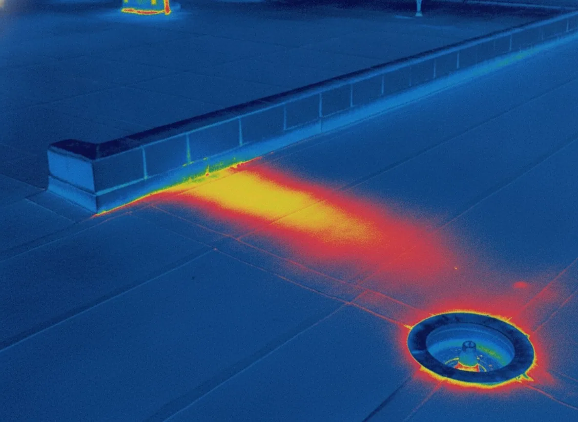
High-resolution images reveal a good deal. Open seams, lifted edges, displaced flashings, ponding stains, debris around drains, missing fasteners and damaged coatings all show up. Thermal imagery, where flown, adds a view of temperature differences that can point to wet insulation, though we confirm with an infrared moisture survey and cores before calling it.
Images are tagged to a position on the roof plan. A manager who opens the file in a year can find the same corner, compare the two photographs and see what changed. That before-and-after view is where aerial images earn their keep. Each image also carries the date, the altitude and the camera settings, so a later reader can tell a real change from a difference in light. If a section of membrane looked fine in one flight and shows a new stain in the next, the file points straight to it.
Where a Drone Falls Short
A camera cannot press on a spongy membrane, hear a hollow seam or probe a sealant bead. It cannot see under a rooftop unit or through a layer of gravel. Surface color and shadow can mislead, and some stains are only stains. For that reason every drone survey ends with a short walk of the flagged areas by a person on the roof.
The combination is faster than either method alone, and it gives the property manager a clear reason for each hour spent on the roof. The drone narrows the search, and the walk confirms. On a large roof, the crew can skip long stretches of sound membrane and spend its time on the real concerns, which keeps the inspection fee tied to findings, not to hours of walking.
Flight Days and the Rain Calendar
Beaverton averages about 151 days of precipitation a year, and November through January carry the most. Drones do not fly well in rain, and wet membrane glares and hides detail. We schedule flights for dry days, usually with some sun but not harsh glare, and we avoid high winds that make the aircraft unstable.
Timing matters for what the images show. A flight a day or two after rain shows where water lingers, which tells you about ponding. A flight in a dry spell shows dried staining and surface wear. Some owners combine the two, using the wet-day flight to see drainage and the dry-day flight to record condition. Seasonal repeats follow the same logic: one flight in late winter to capture what the rain did, and one in early fall to capture what the summer did, which gives the repair log a pair of images per year to work from.
Large Roofs and Hard Access
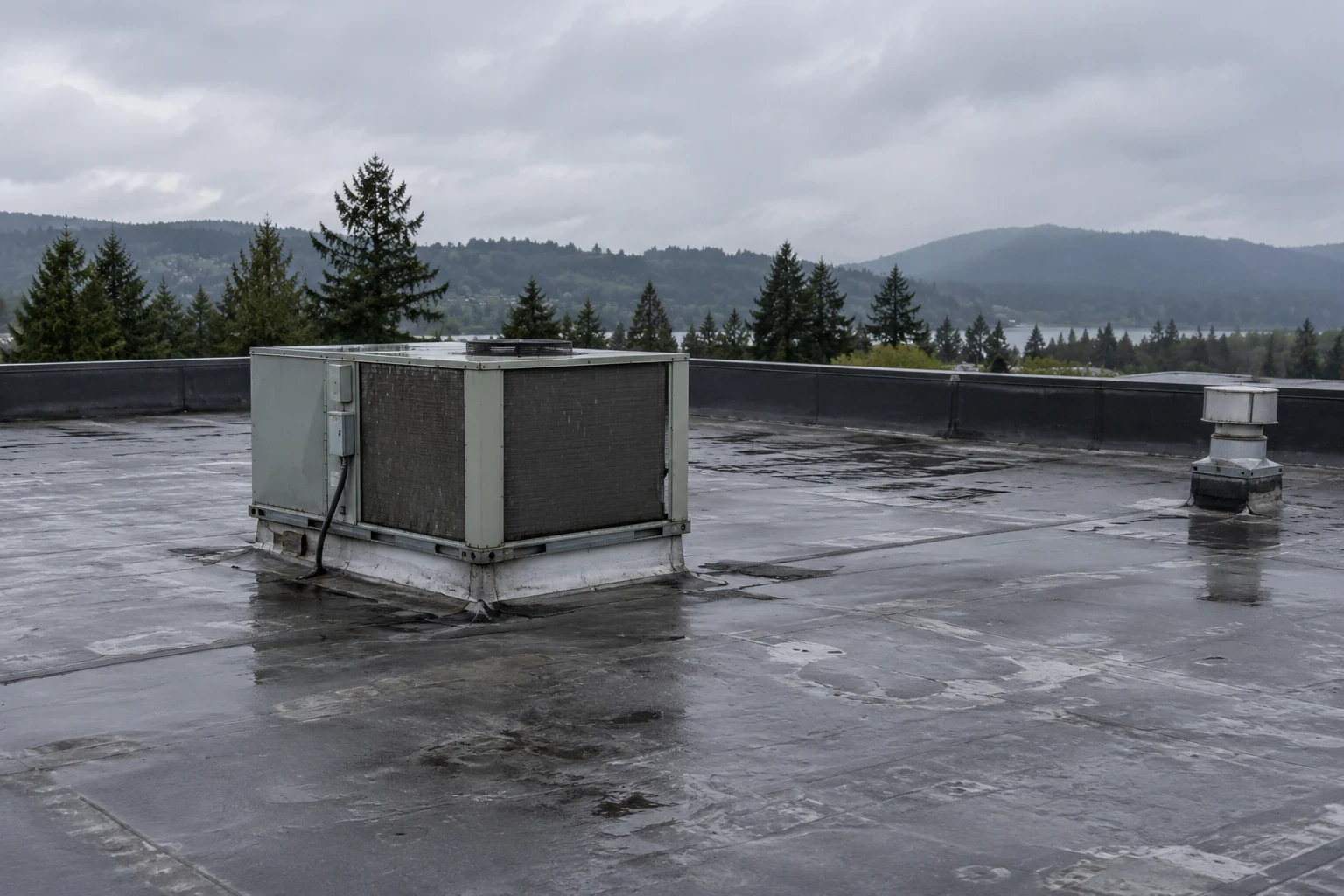
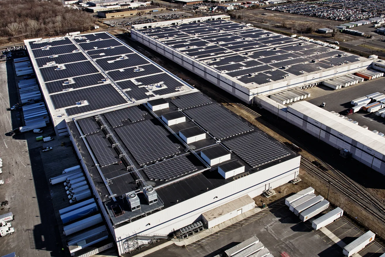
The method suits big and complex roofs: multi-level buildings, steep or fragile surfaces, and buildings where roof access means shutting down operations. Industrial parks straddle I-5 in Wilsonville, and Hillsboro's industrial district holds over half of that city's employment. Buildings in those areas, and warehouse roofs generally, are good candidates for aerial survey because the surface is large and the walk is long.
For a property manager with many buildings, drone surveys also standardize the first look. Each roof is flown the same way, which allows quick comparison. Hillsboro, where Intel employs about 20,000 workers and manufacturing is the largest sector, is a market where roof access on working industrial buildings becomes a scheduling question, and a drone flight keeps people off the membrane until a walk is needed.
Safety and Scheduling Benefits
Roof access carries its own risk: fall exposure at unprotected edges, fragile skylights, slick membrane and hot surfaces in summer. A drone lets us see the whole roof before anyone steps onto it, so the crew knows where the skylights, soft spots and open edges are. The walk that follows is shorter and better targeted.
For buildings with sensitive operations, such as food handling, clean rooms or data equipment, fewer people on the roof means less risk of debris, dropped tools or disturbed equipment. The flight itself rarely needs an interior shutdown. Property managers can approve a drone visit with a short notice to tenants, and the images arrive within a day or two, ready to guide the next decision about repair, survey or replacement.
Images Become Records
Raw images are not the product. We deliver an annotated set: the overview, the marked problem areas, close-ups of each finding and a short note on what each means. The set slots into the condition report and sits in the building file for later reference.
For owners building a long-term picture, annual flights create a time series. Changes in ponding, staining and membrane color are easier to see across years than in a single survey, and the series supports roof asset management decisions about timing and budget.
Related Roofing Work
Infrared Moisture Survey
Wilsonville
Warehouse Roofing
Hillsboro
Schedule a flight
Send the address and roof outline. We plan the flight, collect the images on a dry day and deliver an annotated set with a walk of the flagged areas.
Questions About Drone Roof Inspection
Can a drone replace a hands-on roof inspection?
No. It speeds the survey and records the surface, but it cannot test softness, probe seams or see under equipment. We use it to direct the walk, then confirm each flagged item on the roof.
Do drone flights disturb tenants or operations?
Very little. The aircraft is quiet at roof height, and a flight is short. We notify the property manager and confirm that no one needs to be on the roof, which often makes the survey less disruptive than a crew walk.
What weather stops a drone flight?
Rain, strong wind and low visibility. Harsh glare also hides detail. We reschedule for stable, dry conditions, and a flight set a day after a storm can show where water is standing.
Do you provide thermal images too?
Where the building and conditions allow, yes. Thermal images show temperature differences that may indicate wet insulation. They are a clue, not a confirmation, so we verify with a moisture survey and cores.
What do I get at the end of a drone survey?
An annotated image set tied to the roof plan, close-ups of each finding, and a summary. It becomes part of your building file, and next year's flight can be compared directly against it. Where a finding needs follow-up, the set also lists the recommended next step, whether that is a repair, a moisture survey or a closer look at one detail.